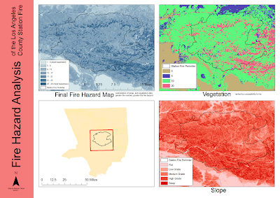
On the surface, this tutorial and lab seemed quite simple, but once I dove head in into the project, I experienced much difficulty and confusion. The tutorial was well written like most of the tutorials we have completed, but I think what the tutorial lacked was a clear sense of exactly what we were doing and what the different maps we were to create were going to symbolize and display. I worked through and completed the tutorial quite quickly, and had a basic understanding of what the tutorial was teaching me.
Once I began to work on the station fire map, I was confused as to which maps I need to display for the final product. I made several maps including a slope, and vegetation type, as we made in the tutorial. But then I figured the most important map was a fire hazard map combination of the slope and vegetation flammability maps. So I set forth and began to work on these maps.
The first major problem I ran into was reclassifying the slope from the DEM. I kept running into large numbers that were not useful. I made sure that I was reclassifying into percent, but it still gave me large numbers. But with the help of classmates I was able to classify them correctly as well as combine the two to make a fire hazard map.
No comments:
Post a Comment